Key Highlights
- Faster Turnaround Times: You’ll get your survey results much quicker than traditional ways. This helps keep your projects on track.
- Cost-Effective Solutions: Drone surveys can save you a lot on labor and equipment costs. They are a friendly option for your budget.
- Uncompromising Accuracy: You will get high-quality data and detailed 3D models. This ensures your measurements are correct for making wise choices.
- Enhanced Safety: Use drones to lower risks tied to surveying tough or dangerous areas.
- Advanced Technology: We use the newest drone models and mapping software. This gives you modern surveying solutions that fit your needs.
Introduction
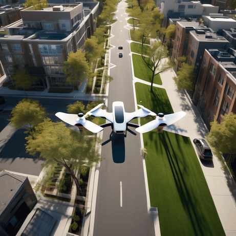
In today’s fast-changing world of technology, drone surveying is changing the way we do property surveys. Survey drones are safer, more efficient, and less expensive than old methods. Topline Pavement Services is leading this change by offering professional drone property surveys. They provide businesses and individuals with the precise and detailed data they need, captured through high-quality drone images.
Understanding the Challenge of Traditional Property Surveys
Traditional property surveys are important, but they come with some challenges. Using ground-based tools and manual measurements can take a lot of time. It also makes it hard to reach tough areas. For businesses in Ontario’s different landscapes, this might cause project delays and higher costs.
Also, the usual surveys often don’t show all the changing details of a property. This is especially true in places with thick plants or complicated buildings. This shows us that we need a better, more flexible way to do property surveying.
Limitations of Conventional Surveying Techniques
Conventional land survey methods are reliable, but they have some limits. They can be slow, especially when surveying large areas. This may delay projects, especially when you need accurate survey data for planning.
These methods may not work well in all areas. Steep hills, thick bushes, or bodies of water can make it hard for surveyors to do their job safely. This is where drone surveying stands out.
Another problem with ground-based surveys is that they provide a limited view. Traditional methods gather some data points, but then you need to estimate the rest. In contrast, drone surveying offers a full aerial view. It collects many data points and helps create detailed maps and models.
The Impact on Project Timelines and Costs
One major issue with traditional surveys is that they can take a long time to finish. The time it takes to do a traditional survey can be quite high, depending on factors like the property size and its shape. These delays can impact later stages of the project, which can lead to higher costs and slower schedules.
The costs of surveys can also go up when using old methods. Having larger teams, special tools, and longer timeframes adds to labor, transport, and operational costs. Many businesses are looking for other options to reduce these costs without losing survey data accuracy.
Drone surveying is a great solution to these problems. It can dramatically shorten project timelines and lower survey costs. With the speed of collecting data from the air, along with advanced processing techniques, projects can start faster and budgets can be managed more accurately.
Introducing Drone Property Surveys with Topline Pavement Services
Topline Pavement Services focuses on drone property surveys. We use the latest technology to give you accurate and fast surveying solutions. Our goal is to help clients in Ontario improve their projects. We do this by providing high-quality data, so they can make smart decisions.
Our team has skilled drone pilots and data analysts. They work together to make sure every step of the survey process is done well, from planning to reporting. When you choose Topline Pavement Services, you will get a smooth experience and dependable results.
Comprehensive Overview of Drone Surveying Services
At Topline Pavement Services, we provide a comprehensive range of drone surveying services, including aerial photography. These services are designed to meet the different needs of our clients. We have a lot of experience with projects that include aerial imagery, data collection, and analysis. Whether you need a basic site survey or a detailed topographic map, our team can help you get great results.
Our drone surveying services offer useful insights into many parts of a property. We can find possible hazards, check accessibility, watch construction site progress, and create accurate volume measurements. Our aerial data helps businesses in various fields.
We know that every project is different. That’s why we collaborate with our clients to understand what they need and adjust our approach to fit. Our aim is to not just give data, but to show it in a simple, clear, and useful way.
Key Benefits: Accuracy, Efficiency, and Safety
Aerial surveying with drones offers a strong reason to update traditional surveying methods. The benefits go beyond better data collection. They include improved safety, more efficiency, and better project results. Let’s explore how these benefits add real value:
- Efficiency: Drone surveys can cut down the time it takes to collect survey data when compared to old methods. This leads to faster project completion times and better productivity.
- Safety: Drones can safely reach and survey places that are dangerous or hard to access with traditional techniques. This helps protect surveyors, especially in tough areas.
- Accuracy: Drones use high-resolution cameras and sensors to gather precise data points. This leads to accurate surveys, which are important for making smart decisions when planning and carrying out a project.
These benefits make drone surveying a great option for businesses in Ontario. Topline Pavement Services can help you use this technology to reach your project goals.
How Drone Property Surveys Work: A Step-by-Step Guide
Understanding how our drone property surveys work can help you see the effort we put into getting accurate results. We have simplified our process to make things easy and clear for our clients.
From the first meeting to the final report, our team is here to help you at every step. We will answer any questions you have along the way. Here’s a look at how we make drone surveys fast and effective.
Initial Consultation and Project Planning
Our process starts with a thorough first meeting. This helps us understand your project needs. During this time, we collect details about the property, the type of survey you need, and what you hope to achieve. This teamwork helps us choose the right type of survey and customize our plan to fit your needs.
After the first meeting, our team creates a clear project plan. This plan includes what we will do, timelines, and what we will deliver. It acts as a guide for the whole survey process. It makes sure that everyone is on the same page and informed at every stage.
We value being open and communicating well. Throughout the planning stage, we keep in touch to answer any questions or concerns you might have. We trust that having a clear plan is key for a successful drone survey.
Flight and Data Collection Process
Once we finish the project plan, our team of skilled drone pilots will start the flight and data collection process. We use advanced drones with high-quality cameras and sensors. This helps us take many overlapping aerial images of the property.
Our pilots follow strict safety rules and regulations. This keeps everyone safe throughout the flight. We focus on ensuring the safety of our team and the area around us while we collect data. We know that good aerial mapping depends on accurate data capture. Our team is committed to keeping high standards.
After the flight, we use special software to process the data. This creates accurate and detailed 2D maps, 3D models, and other necessary deliverables.
Data Analysis and Reporting
After we finish collecting data, our expert team processes and analyzes the drone imagery. We use special software called photogrammetry for this job. This careful work helps us pull out useful information and change raw data into clear insights.
We create detailed survey reports that show our findings in a straightforward and simple way. These reports usually come with high-quality images, terrain models, contour maps, and other visuals made just for your project.
We always focus on quality in our reports. We want to give you data that is not only correct but also easy to understand. This helps you make good use of the information. We are always here to go over the findings and answer any questions you might have.
Why Choose Topline Pavement Services for Your Survey Needs
Topline Pavement Services is a leader in drone surveying in Ontario. We offer experience and skill, and we are dedicated to going beyond what our clients expect.
We don’t just provide a service; we create partnerships. These partnerships are based on trust and reliability. We focus on delivering results that help our clients make smart decisions.
Expertise in Drone Technology and Local Regulations
Our team of trained drone pilots knows a lot about the latest drone technology. They follow all local rules for flying drones. We care about keeping our projects safe and professional.
It is essential to understand the rules for drones in Ontario. This helps us fly safely and legally. Our team keeps up with all the rules and guidelines. This way, we make sure that every survey we do is responsible and ethical.
We see that the land surveying industry keeps changing. We are dedicated to always learning more and getting better. We invest in our team’s development to stay at the front of drone technology and follow the rules.
Tailored Solutions for Ontario Businesses and Consumers
We understand that each project in Ontario is different and needs a special plan. At Topline Pavement Services, we are proud to work closely with our clients. We want to know their needs and customize drone survey solutions just for them.
Whether it is for a busy construction site in Toronto or a land development project in a quieter area, our team uses its skills and technology to deliver the best results for your project in Ontario.
Our aim is to give our clients the detailed data they need. We present it in a way that fits their project needs. We value being open, working together, and clear communication during the survey process.
Commitment to Quality and Customer Satisfaction
At Topline Pavement Services, we are dedicated to quality. We aim to provide drone services that meet top industry standards and go beyond what clients expect. Our main goal is customer satisfaction.
We know that trust must be earned. From your first meeting to when you receive the final report, our team is here to offer great service, clear communication, and dependable results. We are always ready to help with any questions or concerns.
When you choose Topline Pavement Services, you choose a partner focused on your project’s success. We work hard to make sure our drone surveys give you the correct and timely data needed to make smart choices.
Real Success Stories: How Our Drone Surveys Made a Difference
The real way to see how well we are doing is by looking at the good effect our drone surveys have had on our clients’ projects. We gladly share real examples of how our services change things for the better.
These case studies show how flexible drone technology can be. They also show our promise to provide great results in different areas.
Case Study 1: Enhancing Construction Project Efficiency
A well-known construction company in Toronto was having delays because traditional surveying methods were not enough for their large project. The site’s tricky terrain and the need for regular updates created big problems.
We sent our drone surveying team to take aerial photos and do mapping on the construction site. The clear images and detailed 3D models gave valuable information about how the project was moving along.
With the ability to track progress closely, find possible problems, and make timely changes using the drone data, the project’s efficiency improved. This reduced delays and helped save money.
Case Study 2: Accurate Land Development Planning
A land development company needed accurate land information for a new neighborhood. They required clear property lines and detailed surface data. Using old methods would take too long and cost too much.
Our drone surveying team used aerial mapping techniques to create precise surveys. This included elevation models and contour maps. The information helped plan roads, utilities, and other infrastructure.
With drone imagery, we quickly identified property boundaries. This sped up the planning process. The company could move forward confidently while reducing the risk of disputes.
Testimonials from Satisfied Clients
“We were really impressed with Topline Pavement Services. They were professional and quick. The drone survey data they gave us helped a lot with our construction project. We recommend their services!” – John S., Project Manager, ABC Construction.
“Picking Topline Pavement Services for our land development project was a great choice. The detail and accuracy of the drone survey was better than we thought. This survey data helped us plan our project well, saving us both time and money.” – Sarah M., Land Developer.
These testimonials show how committed we are to giving our clients great service and reliable data. We know our success depends on how happy our clients are.
Advanced Capabilities of Our Drone Survey Equipment
At Topline Pavement Services, we use the latest drone technology to deliver great results. Our equipment has advanced features that help us get data that is accurate and efficient.
We keep our fleet updated with the newest tools in drone surveying. This way, our clients get the best available technology.
Latest Drone Models and Mapping Technology
Our fleet has the newest drone models known for being reliable and precise. These drones come with modern features like systems that avoid obstacles and high-precision GPS to collect stable and accurate data.
We use advanced photogrammetry software to process the drone photos. This software helps create high-resolution 2D maps, detailed 3D models, and other special data products.
We are committed to using the latest mapping technology. This way, our clients get accurate, detailed, and useful insights for their projects. We believe in using technology to its full potential to achieve great results.
Specialized Sensors for Different Surveying Needs
Our drones can do more than just take high-resolution photos. We can add special sensors for different land surveying needs. For example, multispectral sensors help us gather information beyond what we can see. They give us important details about plant health and help find issues that are hard to spot.
LiDAR sensors, which stand for Light Detection and Ranging, help us create very precise 3D point clouds. This is useful in tough situations, like areas with lots of trees. The information from LiDAR surveys is key for things like managing forests, checking powerlines, and mapping digging sites.
These special sensors make our drone surveys even better. They let us help more industries and meet the needs of land surveyors, engineers, environmental experts, and other professionals.
Preparing for Your Drone Property Survey: What You Need to Know
Preparing for your drone property survey with Topline Pavement Services is easy. We want to make the process simple and smooth. We keep you updated every step of the way.
Here’s a quick look at how to book your survey and a checklist to help things go well.
Booking Process and Timeline
Booking a drone survey with Topline Pavement Services is easy. You can reach out to our team by phone or email to talk about your project needs. We are happy to help with any questions you have about the process and give you a custom quote.
Once you choose to go ahead with Topline Pavement Services, our team will help you find a good date and time for the survey. The time it takes for the survey can change. It depends on things like how big and complex the site is, the weather, and what data you need.
We know that time matters, and we work hard to finish surveys quickly while making sure they are good quality. Our team will give you an estimated time and keep you updated on how things are going.
Pre-Survey Checklist for Clients
To have a smooth and good drone survey, here are some things you can do to get ready for the survey site:
- Clear the Area: Take away any things that might block the drone’s flight. This includes vehicles, equipment, or low branches.
- Secure Pets: If you can, keep pets indoors during the survey. This helps stop distractions and keeps them safe.
- Open Access: Make sure our team can easily access all parts of the survey site, including any gates or locked areas.
By following these easy steps, you will help us do a great job in the drone survey and gather the best data for your project.
Navigating Legal Considerations for Drone Surveys in Ontario
Drone operations in Ontario must follow the rules set by Transport Canada. Topline Pavement Services focuses on compliance. We make sure all our drone surveys meet these guidelines to keep everyone’s safety and privacy secure.
We are dedicated to using drones responsibly. Our team keeps updated on the latest rules to work within the law.
Compliance with Local Laws and Regulations
Operating drones for business in Ontario needs to follow strict rules. You must get a Special Flight Operations Certificate (SFOC) from Transport Canada. Topline Pavement Services follows these rules carefully. This keeps our drone work safe and legal.
Our team makes sure to stay informed about the latest laws in Ontario about drone use. This includes rules about how high we can fly, staying away from airports, and protecting data privacy. We have set up clear procedures to make sure we follow these rules every step of the way.
When you choose Topline Pavement Services, you pick a company that values safety. We respect your privacy and follow the laws of Canadian aviation.
Privacy and Data Protection Measures
At Topline Pavement Services, we know that privacy and data protection are very important, especially for aerial surveying. We have strong steps in place to keep people’s privacy safe and to protect any personal information we gather during our work.
Our team is trained to carry out drone surveys carefully. They avoid flying over private property without permission or taking pictures of people without their consent. We follow strict rules to handle data, making sure that any information we collect is stored safely and used only for its proper purpose.
We believe in being open and clear with our clients about how we protect data. If you have any worries or questions, please reach out to our team.
Conclusion
In conclusion, Topline Pavement Services provides a new and advanced way to do property surveys with expert drone surveying. Using drone technology helps us be accurate, efficient, and safe in all our services. We focus on quality and have special solutions for businesses in Ontario that make us unique. You can see how our drone surveys improve the speed of construction projects and help in careful land planning. Trust us for your survey needs. We handle legal matters smoothly while giving you great results. Work with Topline Pavement Services for outstanding drone surveying.
Frequently Asked Questions
How accurate are drone property surveys?
Drone property surveys are very accurate. They can get measurements within a few centimeters. This accuracy can change based on some things. These include the equipment of the drone, the type of terrain on the piece of land, and the use of ground control points (GCPs) during topographic surveys.
How long does a drone survey take?
The time it takes to do a drone survey can change based on how big the project is and how much data collection is required. Still, drone surveys are much faster than traditional methods. They can gather aerial images in just a few hours.
Can drone surveys map any property size?
Yes, drone surveys can be changed to map different sizes of property. It doesn’t matter if it is a small home lot or a large farm area. Our drone can do aerial mapping for fast and clear land surveys for any piece of land.
What sets Topline Pavement Services apart from competitors?
Topline Pavement Services stands out because we always focus on making our customers happy. We use the latest drone technology. We also take a personal touch by creating custom solutions for each client’s unique needs.